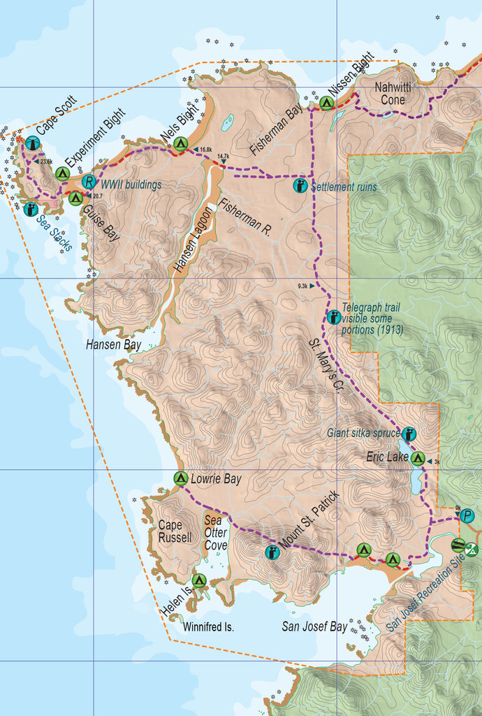
A map showing the Cape Scott Trail from San Josef Bay to the lighthouse. The eastern extension is the North Coast Trail and continues another 43 km to Shushartie Bay. For a detailed waterproof map of this region, see the North Coast Trail mapsheet.
This is one of Vancouver Island’s wildest and most scenic parks, protecting the entire north coast of Vancouver Island from San Josef Bay around Cape Scott to Shushartie Bay near Port Hardy. As for being scenic, it is the storm-battered northern limit of the island, but somewhat unexpectedly, it is also a charming mixture of expansive sand beaches, swampy forest and unusual features ranging from sea stacks to a desert-like sand tombolo.
The Cape Scott Trail: This is the original trail that runs from San Josef Bay to the cape for a total distance of 23.6 km. It is about eight hours, depending on the amount of mud and water on the trail, which can be substantial. A good method is to hike to Nels Bight to camp there the first night, hike to Cape Scott in the second day and return the third. It could be considered moderately demanding – tough for some, but not those completing the North Coast Trail, who will practically jog back to San Josef Bay in comparison to the pace on the rest of the route.
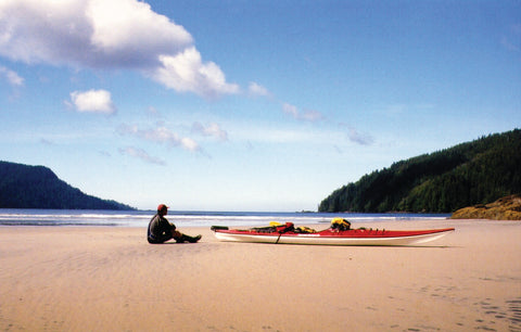
San Josef Bay: Less than a kilometre into the Cape Scott Trail, a side trail leads through some pretty forest to San Josef Bay, a wide, sandy beach divided in two by a headland broken with sea stacks and caves. Tenting is popular on either beach, with pit toilets and bear caches provided in the upland. The trail is 2.5 km from the parking lot to the beach. Note the route between the two beaches is blocked at the headland at higher tides. A rough bypass goes over the headland.

Mount St. Patrick: Hikers on the San Josef Bay trail can round the beach to the far west extent, then take a rough trail up Mount St. Patrick. A sign states the trail is unsafe, but it’s really simply unimproved, meaning exposed roots and mud. It follows the northern edge of a lower ridge then drops down a valley and rises quickly to the peak. Here heavy forest gives way to a subalpine environment of stunted trees and bog. The peak provides panoramic views over the countryside in all directions. Those who are determined can extend the trip down the west ridge to Sea Otter Cove, a total distance of about 10 km. At low tide the cove can be rounded via the beach to a rough route leading to Lowrie Bay.
Lowrie Bay: A good sand beach and spectacular surf are the main features of this remote bay, reached only occasionally by kayakers or hardy hikers. A cabin offers shelter if needed.
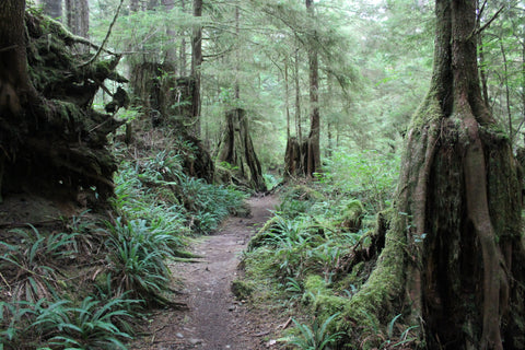
Eric Lake: This is the first campsite within the park on the Cape Scott Trail, at 3 km. Hikers often arrive late and hike here to spend the first night. It is set on boardwalk and is pleasant but is very dark at night and prone to mosquitos. Remnants of the Danish community can still be seen in a corduroy road built in 1908 south of the lake and a wharf at the south end of the lake. The lake served the community before a trail was built to bypass it. Another remnant is a telegraph line that was built to Cape Scott in 1913. On the northeast side of the lake look for a giant Sitka spruce with a 7.2-m circumference.
The settlement: At 13.1 km along the trail a junction gives a choice of routes. Continue north along a rough section to Nissen Bight, a popular camping area, or turn west and travel to Nels Bight and the other beaches on the route to Cape Scott. Near the junction are several historic features including the burial site of an adopted son of the local schoolteacher. William Christiansen died at the age of 12 from an infected cut on his foot in 1906. The pink granite gravestone is just east of the trail near the junction. Just west of the junction is the old settlement’s townsite. Most indications have disappeared, but look for a wooden cart and a collapsed tool shed at the Spencer farm site north of the trail. A caterpillar tractor between two trees north of the trail was the first motor used at the settlement.
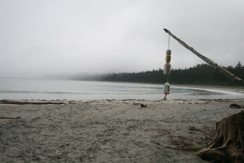
Nissen Bight: This beautiful curving sand beach is reached by continuing north along the trail, 15 km from the trailhead. Most campers tend to stay on the more protected west shore, though driftwood wind baffles have been created along the length. Water is from a creek at the far east end of the bight. Toilets and bear caches are just west of the beach.
Fisherman Bay: This small cove makes a good place to explore if you are camping at Nissen Bight. A rusting hulk is a reminder of an ill-fated attempt by the Cape Scott settlement to create a breakwater. The old sailing ship washed up from storms soon after it was put in place.
Hansen Lagoon: A major feature of the old settlement was fields created by dyking Hansen Lagoon. The first dyke, built in 1899, runs 720 metres just east of Fisherman River. The second dyke, along the northwest shore of the lagoon, was built in 1905. The dykes have failed and have since become ditched and the fields rutted. An old boiler used in 1898 for a milk condensery is stuck in the riverbank in the middle arm of the Fisherman River.

Nels Bight: This is the most popular campsite, at 16.8 km from the trailhead. Water is from a creek on the west side of the bight. You will also find bear caches and toilets here.
Guise Bay: From Nels Bight the trail crosses a headland, then drops to a beach on the east side of Experiment Bight before crossing to Guise Bay, a camping area at 20.7 km. Look for the evidence of a Second World War military presence here, including a plank road built in 1942, a collapsed building off a short side trail, and a couple of ruined cabins used as barracks. Guise Bay has a bear cache, toilets and water at a small creek that may be difficult to reach. Fencing, farm implements and the N.P. Jensen grave on the beach’s west end are reminders of the attempt to farm this inhospitable portion of coast.
Experiment Bight: Hikers can bypass the main trail by continuing along Experiment Bight instead of crossing immediately to Guise Bay, then crossing at the sand neck. Look for a depression that played a role in Kwakwaka’wakw mythology as a footprint of Kanekelac, a creature that could step from Cape Scott to Triangle Island in a single step. The bight is occasionally used as a campsite, but lacks water or facilities. The sandy neck is an incredible feature of Cape Scott, contributing desert-like dunes to this very wet part of the world. The ecology is unusual due to the introduced species brought in by the Danish to vegetate the sand.
Sea stacks: A short side trail west of Guise Bay leads to a small beach with some sea stacks. Portions of the trail here follow an old Second Word War-era plank road for use by the lighthouse.
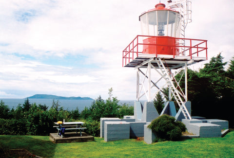
Cape Scott: The lighthouse atop the headland of Cape Scott has only been in place since 1960. The grounds of the lighthouse are open to visitors; a picnic area overlooks the Scott Islands, a string of remote islands as near as 10 km at Cox Island and as distant as 46 km at Triangle Island. The islands are the largest marine bird nesting site in British Columbia, protected in Lanz and Cox Islands Provincial Park and three ecological reserves: Beresford Island, Sardine Island and Anne Vallee (Triangle Island). A trail once led from the lighthouse to a bridge out to a rock, but it has been closed for safety considerations. The lighthouse is now the end of the road on Vancouver Island.
